
Urbanie & Urbanus
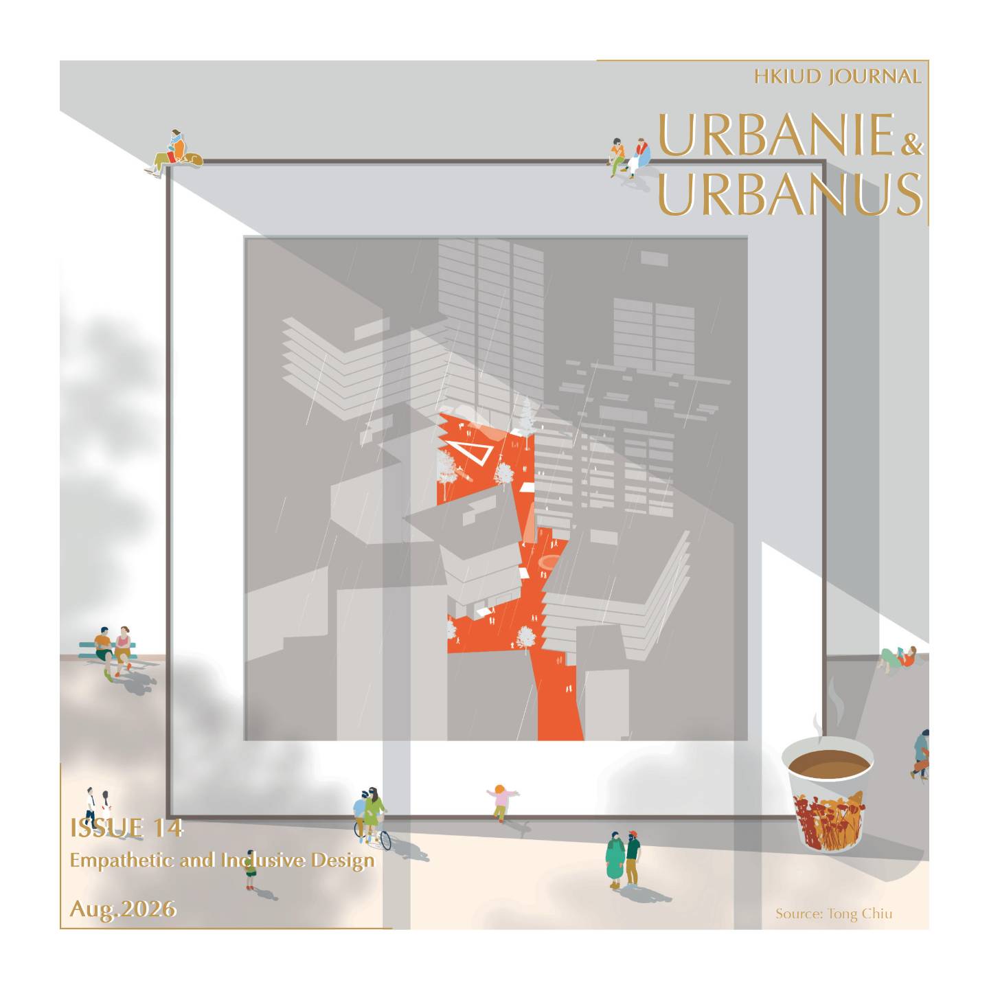
Issue 2026 Aug
Empathetic and Inclusive Design
Issue 14, P. - P.
Empathy Beyond Comfort: Friction, Variety and Memory as Social Infrastructure in Hong Kong’s Dense Urbanism
Figures
.jpg)
Figure 1. Hong Kong: The Disappearing Street A pedestrian rushes across a busy road beneath dense high-rise buildings, revealing a street condition where sidewalks barely support basic movement, let alone pause, encounter, or social life. Source: Author, 2015.
.jpg)
Figure 2. Maritime Square as an MTR-Integrated Shopping Mall A typical Hong Kong podium mall where transport access, escalators and retail circulation are closely integrated. Pedestrian movement is channelled through interior commercial routes, increasing shopfront exposure and dwell time while reducing the role of the street as the primary public interface. Source: Malls.com — Maritime Square.
.jpg)
Figure 3. Typical podium-and-footbridge urban condition in Hong Kong, where elevated circulation, transport infrastructure, and shopping mall access compress the street into a traffic-dominated and uncomfortable ground level. Pedestrians are crowded along narrow edges, while bus terminals, noise, and vehicular movement reduce the street’s capacity for staying, waiting, and everyday social life. Source: Author, 2025.

Figure 4. A City Seen From Above, A Life Lived Below Finished size: 800 Å~ 800 mm, resized to 300 Å~ 300 mm | Digital illustration with simulated paper texture A planner’s-eye view of Sheung Shui, where red-hatched building volumes above 10 metres dominate the drawing and obscure the everyday spaces beneath. The red layer represents what top-down planning often privileges: vertical massing, density, and development efficiency. Yet much of daily life takes place below this layer, at street level and along the footbridge network. In the original physical drawing, a red lens could be used to filter out the dominant massing and reveal the lived city below; in this reproduced figure, the image records that contrast between planned density and everyday urban life. Source: Author, 2025.
.jpg)
Figure 5. The Ground We Lost: Re-sorting Sheung Shui Masses Finished size: 140 Å~ 720 mm | Diagram Drawing Extending the conceived map through a Nolli-inspired method, this drawing highlights building mass across the Sheung Shui study area at 1:2000, then realigns and sorts the figures by size. A pattern observed through this exercise is that newer developments tend to claim larger and more continuous ground coverage. As shared and reachable ground is progressively given up, urban life is increasingly reduced to point-to-point circulation, with fewer chances to pause, encounter, or linger. The drawing therefore asks whether the ground can be designed and reclaimed differently, so forms of street life that once appeared more naturally may re-emerge. Source: Author, 2026.
.jpg)
Figure 6. Social Distancing in Hong Kong during COVID-19 Social distancing marks on restaurant seating during the COVID-19 outbreak illustrate how even minimal forms of public encounter were temporarily restricted. The pandemic highlighted that dining out and occupying shared spaces are not only functional activities, but also basic forms of social contact, environmental change and participation in urban life. Source: Reuters / Tyrone Siu, 29 March 2020, via The Jakarta
.jpg)
Figure 7. Reframing the Traffic-Oriented Street Originally produced by Karl Jilg for the Swedish Road Administration to illustrate traffic safety and pedestrian vulnerability, this drawing is read here as an ironic critique of car-oriented urban perception: how streets become psychologically accepted as vehicular territory, while pedestrians are left to move humbly along the margins. Credit: Karl Jilg / Swedish Road Administration.
.jpg)
.jpg)
Figure 8. Podium Urbanism at Tseung Kwan O Plaza Two views illustrate a typical podium-style development in Tseung Kwan O, where the ground plane is dominated by taxi drop-offs, bus bays, loading areas, E&M facilities and back-of-house servicing. Retail is lifted into the podium above, leaving few active street-facing shopfronts and directing pedestrians toward interior, air-conditioned circulation routes rather than the street. Source: LeasingHub — Tseung Kwan O Plaza.
.jpg)
Figure 9. Podium-Tower Public Housing Typology in Tseung Kwan O Kin Ming Estate shows a typical Hong Kong public housing estate where residential towers are raised above a podium base, with ground-level space shaped by transport access, servicing, and circulation. The image illustrates how podium urbanism can detach everyday housing life from the street, turning the ground into movement infrastructure rather than an active public realm.
.jpg)
Figure 10. Searching for a Free Open-Air Seat in Wan Chai A scene from a Mill MILK video showing the difficulty of finding a free, non-commercial, open-air place for takeaway lunch in Wan Chai. Within the dense commercial district, podiums, malls and point-to-point circulation leave few places to sit without paying. A table is eventually found only farther away at the promenade park, revealing how basic needs such as shade, air, seating and eating space are displaced from the inner city. Source: Mill MILK, YouTube video, accessed 2026.
.jpg)
Figure 11. Spring Garden Lane Sitting-out Area, Wan Chai A typical small urban park in Hong Kong, enclosed by high planter edges, fences and gated entrances. Curbside parking further weakens visibility and access from the street, making the space feel isolated and inward-looking rather than a natural extension of everyday pedestrian life. Source: Google Street View.
.jpg)
Figure 12. East Coast Park Precinct, Fortress Hill A recent harbourfront development illustrating a more open and continuous form of public space, accommodating walking, sitting, play, pets and informal leisure along the waterfront. Its generous scale and flexible use contrast with the more enclosed and purpose-specific public spaces commonly found within the city. Source: CoastalTrail.hk, “The Opening of the East Coast Park Precinct (Phase 1) in Fortress Hill,” 2021.
.jpg)
Figure 13. Negotiated Use of a Playground Court, Sheung Shui A playground court in Sheung Shui shows how open space is often used through informal agreement rather than fixed programming. Children play basketball lightly while pedestrians cut diagonally across the court, with both sides adjusting to avoid conflict. This tacit agreement reveals a hidden layer of negotiation within everyday public space. At the same time, the scene suggests a limitation of programme-oriented open space. Although designed for play, the court also becomes a shortcut and waiting space, indicating that the neighbourhood may lack more flexible places for lingering, passing, and informal occupation. Source: Author, 2025.
.jpg)
Figure 14. Corridor Kitchens and Shared Life in Early Hong Kong Public Housing Corridor kitchens in early Hong Kong public housing reveal how limited space and shared amenities once turned circulation into an everyday communal interface. Although produced by material shortage, these conditions allowed cooking, passing, conversation, and neighbourly recognition to overlap, suggesting how shared life can emerge from spatial necessity. Source: Hong Kong Youth Hostels Association, Jockey Club Mei Ho House Hong Kong Spirit
.jpg)
Figure 15. Aftermath of the Shek Kip Mei Fire, 1953 The 1953 Shek Kip Mei fire left tens of thousands homeless and became a turning point in Hong Kong’s public housing history. While the disaster exposed the vulnerability of dense squatter settlements, the relatively limited reported casualties compared with the scale of displacement may also suggest strong neighbourly awareness, rapid communication, and informal mutual support within the community. Source: Unknown author, Aftermath of the 1953 Shek Kip Mei Fire in Hong Kong, 1953, Wikimedia Commons / Hong Kong
.jpg)
Figure 16. Cyclical shifts between loose and tight fashion trends as an analogy for changing urban desires The diagram is used metaphorically to suggest how social preferences often rebound when one condition becomes too dominant. In the context of Hong Kong’s increasingly managed and interiorised urban ground, the renewed interest in co-living, co-working and shared communal spaces may reflect a wider desire to recover everyday forms of proximity, informality and encounter. Source: Diagram by the author, incorporating reference images collected from various online sources. Individual image sources are credited where applicable.
.jpg)
.jpg)
Figure 17. Old North Point Estate and Everyday Street Variety The old North Point estate shows a more informal public housing environment, where everyday life extended through local shops, open edges, small businesses, and neighbourhood routines. Although the buildings were ageing and later associated with hygiene, safety, and redevelopment concerns, the estate also carried a strong mixture of users, programmes, and street-level vitality. Source: Our China Story, “香港北角邨”, image reference.
.jpg)
Figure 18. Sanitised Redevelopment and the Loss of Local Vibrancy The renewed development provides a cleaner, more organised, and set-back street environment. However, much of the former variety has been replaced by chain stores, mall-oriented retail, and a more standardised commercial setting. The street space remains physically present, but its informal mixture, local vibrancy, and neighbourhood character are weakened. Source: Google Maps Street View
.jpg)
Figure 19. The Missing Commons: Memory Erased by Efficiency Finished size: 600 × 160 mm | Diagram drawings This drawing reflects on the recurring efficient public-estate template in Hong Kong, where repeated corridor-andunit arrangements are optimised for unit provision and circulation, but leave few spaces for shared commons. Everyday routes become fast and functional, yet socially thin, prioritising point-to-point movement over pause, lingering, and neighbourly encounter. For many residents living decades within these standardised plans, housing becomes functional yet leaves too few places to pause, linger, and accumulate shared memory. Source: Author, 2026.
.jpg)
Figure 20. Typical Public Housing Lift Lobby A typical lift lobby design in contemporary Hong Kong public housing. Source: animod_modeling, Hk Public Housing Corridor 003 3D Model, TurboSquid, 2024.
.jpg)
Figure 21. Typical Public Housing Corridor A typical corridor in contemporary Hong Kong public housing, prioritising point-to-point circulation, efficiency, and compliance with fire escape requirements. Source: Hong Kong Housing Authority, Environmental Report 2020/21: Environmental Performance — Initiatives in Planning and Construction of New Public Housing.
.jpg)
Figure 22. Mapping Wan Chai through Kevin Lynch’s Five Elements A map diagram of the Wan Chai study area, reading the district through Kevin Lynch’s five urban elements: paths, edges, districts, nodes, and landmarks. The drawing identifies how tramlines, main streets, building fronts, market clusters, pocket spaces, and familiar local anchors structure the way Wan Chai is experienced, remembered, and navigated. Source: Author, 2026.
.jpg)
Figure 23. Kevin Lynch’s Five Elements of the City Diagram from Kevin Lynch’s The Image of the City, illustrating the five elements through which people read, organise, and remember urban environments: paths, edges, districts, nodes, and landmarks. Source: Lynch, K. (1960) The Image of the City. Cambridge, MA: MIT Press.
.jpg)
Figure 24. Mixed Users in Cross Street, Wan Chai A Wan Chai inner street showing the everyday overlap of tourists, local residents, office workers, shop owners, service workers, and foreign visitors within the same dense street environment. The image captures the district’s social mixture and informal urban vibrancy. Source: Film Promotion and Facilitation Section, Location Library: Cross Street, Wan Chai, accessed 2026.
.jpg)
Figure 25. Tai Yuen Street Toy Market, Wan Chai A well-known street market and tourist spot in Wan Chai, showing the district’s lively shopfronts, specialised retail, and everyday street character. Source: Expedia, Tai Yuen Street Toy Market Tours, accessed 2026.
_.jpg)
_.jpg)
.jpg)
.jpg)
Figure 26. Street and Plot Definition Author’s diagram showing how existing Wan Chai street widths and plot logic inform the initial massing framework. Source: Author, 2026.
.jpg)
.jpg)
.jpg)
.jpg)
.jpg)
Figure 27. Reinterpreting Composite Building Scale Author’s diagram showing the development of a lower urban base through setbacks, verandas, balconies, and terraces. Source: Author, 2025.
.jpg)
.jpg)
.jpg)
Figure 28. Layering Additional Density Author’s diagram showing how higher-level density is lifted and offset above the street-based urban fabric. Source: Author, 2025.
.jpg)
Figure 29. Upper Densification, Mixed Towers and Pocket Parks The drawing shows how the upper densified zone echoes Wan Chai’s surrounding urban language through facade elements, setbacks, terraces, and balcony rhythms. Four towers with different programmes are arranged as a mixed vertical neighbourhood, integrating pocket parks and shared terraces as communal spaces within the new density. Source: Author, 2025.
.jpg)
Figure 30. Separated Upper Densification Zone, Wan Chai Section drawings showing the separated densified upper zone, designed to accommodate additional floor area while minimising disturbance to the lower streetscape, pedestrian scale, and everyday public spaces. Source: drawing by Author
.jpg)
Figure 31. Projective Isometric View of Wan Chai An overall isometric drawing of an imagined Wan Chai, showing a user-defined and generative urban environment with vibrant streets, a central node, community hubs, and shared spaces that invite people to experience and engage with street life. Source: Author, 2025.
.jpg)
Figure 32. When Densification Meets Community Essence, Wan Chai When densification meets community essence as the tramline flows by. The drawing presents a view of urban dynamicity and community cohesion, capturing how new density, everyday movement, and local street life can coexist within Wan Chai’s evolving urban fabric. Source: Author, 2025.
.jpg)
.jpg)
.jpg)
Figure 33-35. Central Node Plaza and Reimagined Tong Lau Communal Space Central Node Plaza serves as a breathing space amidst the urban hustle, inviting users to pause, gather, and reconnect with nature at the heart of the city. Across the surrounding inner streets, diverse activities, nodes, and levels create a vibrant communal environment, where everyday users and families meander through the reimagined Tong Lau spaces and experience the shared life, greenery, and urban cohesion of the district. Source: Author, 2025.
.jpg)
.jpg)
.jpg)
Figure 36-38. Parallel Trading and Local Contestation in Sheung Shui A series of images showing Sheung Shui before COVID-19, when parallel-trading activity intensified street congestion, pharmacy-oriented retail, and local protest. The images frame Sheung Shui as a contested border district, where external buying power, pedestrian crowding, and everyday neighbourhood disturbance reshaped the local street economy and public life. Sources: Hong Kong Free Press, 2016; North District Parallel Imports Concern Group / ResearchGate; Facebook image source, accessed 2026.
.png)
Figure 39. Toward a New Shared Ground Housing Typology The diagram compares four familiar Hong Kong housing typologies: old public housing estates, Tong Lau, village houses, and newer podium tower developments. Drawing from their different spatial qualities, including shared estate grounds, mixed use street edges, village like thresholds, and podium efficiency, the project proposes a blended social housing typology. It evolves inherited urban languages into a more empathetic and inclusive model, where density, mixed programmes, claimable thresholds, and shared ground support encounter and community life. Source: Author, 2026.
.png)
Figure 40. From Podium Towers to Ground as Living Room A before-and-after design diagram contrasting a typical three-tower podium estate with a reimagined public housing model of fragmented density, varied open spaces, and a more dynamic ground condition. The proposal turns the ground from a servicing base into a shared living room for encounter, movement, and everyday use. Source: Author, 2026.
.jpg)
Figure 41. Massing Development and Mixed Urban Variety A screenshot of the project’s massing development process, testing variety in density, unit size, programmes, and open-space formats, exploring how a public housing prototype can move away from uniform block logic towards a more gradual, mixed, and socially adaptable urban form. Source: Author, 2026.
.jpg)
.jpg)
Figure 42. AI-Assisted Unit Mix and Corridor Layout Study A design study processed with Finch, testing the mix and assignment of programmes, unit sizes, corridors, fire escapes, services, and access cores within each building mass. The study supports the project’s attempt to organise public housing as a varied and workable system, balancing spatial diversity with circulation, servicing, and regulatory constraints. Source: Author, 2026; study assisted by Finch.
.jpg)
Figure 43. Programmed Landscape Park as Shortcut, Sheung Shui A typical landscape park in Sheung Shui, organised by paths, planting, and intended recreational programmes. Although the space provides trees and greenery, locals often pass through it as a shortcut rather than occupy it as an open public space. Source: Author, 2026.
.jpg)
Figure 44. Festival Hawkers and Informal Gathering on the Street During Chinese New Year, temporary hawkers and festival crowds gather along pedestrian paths that were not designed as pocket spaces. Although such street occupation is often controlled, narrowed, or restricted to prevent crowd accumulation, the scene reveals that the demand for informal gathering, seasonal exchange, and streetbased public life still persists within the managed city. Source: HK01, “〖彩園不死〗上水小販重覓地點擺檔”, 2017.
.jpg)
Figure 45. Sheung Shui Business in Transition A long-standing local shop in Sheung Shui closes amid changing retail patterns, reflecting the district’s ongoing transition from traditional neighbourhood commerce toward a more uncertain street economy. Source: The Standard, “Farewell to a local landmark: Sheung Shui’s bamboo mat shop ends half-century operations,” 2025.
.jpg)
Figure 46. Existing Spatial Conditions of Occupation in Sheung Shui The drawing analyses spatial conditions in Sheung Shui where everyday occupation already takes place, including alley corners, streets of varying widths, flow pockets, overlapping street-program interfaces, and active fronts. Together, these conditions show how pedestrian movement, pausing, and informal occupation tend to gather where routes widen, intersect, or meet shopfronts and other active building edges. Source: Author, 2026.
.jpg)
Figure 47. Connectivity Analysis of the Sheung Shui Site A site connectivity analysis produced by the author using UrbanFab, a Rhino/Grasshopper plugin developed by Adaptive Design Lab. Similar to space syntax logic, the diagram scores and visualises the relative connectivity of routes across the site, providing a base reference for locating major flows, potential interfaces, and areas where public life may accumulate. Source: Author, 2026; analysis generated with UrbanFab by Adaptive Design Lab.
.png)
Figure 48. Central Link and Pocket Flows, Mangalem 21 A reference image from OMA’s Mangalem 21 masterplan proposal in Tirana, Albania. The image is read for its use of a key central link, with connected pockets that absorb secondary movement and create moments of pause along the main flow. It serves as a precedent for organising circulation as both connection and social space. Source: OMA, Mangalem 21 masterplan proposal, video still, accessed 2026.
.jpg)
Figure 49. Spatial Enclosure Analysis Methods Two reference diagrams from Modelling 3D Spatial Enclosure of Urban Open Spaces show methods for measuring enclosure through road centrelines and 3D axial lines. They are used here to support the project’s testing of varied spatial conditions, from open routes to sheltered pockets and semi-enclosed edges. Source: Mutlu and Yilmaz, Modelling 3D Spatial Enclosure of Urban Open Spaces, 2016; after Schroder, Mackaness and Reitsma, 2007.
.jpg)
Figure 50. Street-Level Enclosure Before and After Development A paired comparison of the same street scene with and without the proposed building mass. The images test how new development changes the perceived sense of enclosure from street level, showing how building edges, height, setbacks, and spatial proportion can affect pedestrian experience, comfort, and urban spatiality. Source: Author, 2026.
.jpg)
Figure 51. Open Corridor Commons and Second-Level Retail Connection The drawing shows the project’s attempt to open residential corridors and connect them indirectly to the second-level retail podium. Unlike typical enclosed public housing corridors, this semi-open arrangement creates a psychological shift in what feels private, shared, or publicly accessible. Circulation becomes a lived threshold, where residents can pause, observe, and feel connected to everyday activity beyond their own units. Source: Author, 2026.
.jpg)
Figure 52. Hotel Corridor and Retail Interior as Shared Threshold, Marina Bay Sands This image is used as a reference for the psychological shift created when hotel-room circulation connects directly to a large interior retail world. Unlike a typical enclosed hotel or housing corridor, where stepping out may still feel semi-private and casual, this condition makes the corridor feel immediately connected to public activity. The boundary between what is private, shared, and publicly accessible becomes less fixed, inspiring the project’s rethinking of public housing corridors as semi-open commons. Source: Tripadvisor, Sands Expo and Convention Centre, Singapore, accessed 2026.
.jpg)
Figure 53. Semi-open Corridor, Balcony and Unit Layout Studies A series of design studies testing semi-open corridor arrangements, balcony placement, and flat layouts. The diagrams explore how balconies can shift from isolated private add-ons to claimable thresholds along shared corridors, creating more opportunities for ventilation, visibility, neighbourly pause, and everyday personalisation. Source: Author, 2026.
.jpg)
.jpg)
Figure 54. Corridor Commons and Claimable Thresholds These two reference images show corridor and access spaces that operate beyond simple circulation. In Footbridge on the Water Residential Building, the walkway becomes both access and outdoor living space, supporting views, leisure, social interaction and a sense of togetherness. Creative City Neu Marx is read as a reference for a more informal corridor common, where people can stay, linger, display objects and personalise shared edges. Source: LOVE architecture and urbanism, Footbridge on the Water Residential Building, ArchDaily, photographs by Jasmin Schuller, 2021; Patricia Bagienski, Creative City Neu Marx, Behance, 2017.
.jpg)
Figure 55. Ventilated Corridor Logic in Early Hong Kong Public Housing Ming Wah Dai Ha shows an early public housing model with central corridors facing an open atrium. Wire mesh edges allow light, ventilation and visual connection, forming a semi open access space rather than a sealed corridor. However, without mixed retail or public programmes, corridor customisation can remain unsupported, sometimes becoming neglected space rather than an active threshold for everyday use and neighbourly interaction. Source: HK Estate, “廊走過明華大廈”, Facebook photograph of Ming Wah Dai Ha, 2014, accessed 2026.
.jpg)
Figure 56. Deliberate Balconies as Customisation Capacity The drawing shows intentionally provided balconies as spaces for residents to customise, plant, decorate, store, and spill everyday life outward. Rather than treating balconies as luxury or leftover space, the project uses them as adaptable buffers that invite users to shape their own thresholds. Source: Author, 2026.
.jpg)
Figure 57. Public–Private Thresholds and Personalisation A diagram from Responsive Environments showing how personalisation often occurs at the threshold between public and private space, where users can adapt visible and claimable edges. Source: Bentley et al., Responsive Environments: A Manual for Designers, 1985.
.jpg)
Figure 58. Under-defined Pockets as Spaces for Negotiation The drawing shows under-defined pockets left between routes, columns, shaded edges, and building fronts. Inspired by the way activity in Sheung Shui settles like river sediment where pedestrian flow slows down, these spaces are designed to remain open for residents and passers-by to pause, claim, negotiate, and gradually shape through everyday use. Source: Author, 2026.
.jpg)
.jpg)
Figure 59. Making Space, Leaving Space An example from Herman Hertzberger’s Lessons for Students in Architecture, showing how the space between classrooms is opened up and used as a porch-like area for occupation. Rather than defining the corridor only as circulation, the design leaves a degree of openness and ambiguity, allowing students to pause, gather, and appropriate the threshold between rooms. Source: Hertzberger, H., Lessons for Students in Architecture, 1991
.jpg)
Figure 60. Occupied Pockets and Everyday Appropriation An example from Herman Hertzberger’s Lessons for Students in Architecture, showing how simple architectural elements, such as a parapet wall, edge, or pocket-like threshold, can generate informal occupation. Rather than prescribing a fixed programme, the space offers the right degree of openness and support, allowing people to naturally gather, sit, chat, and appropriate it for different activities over time. Source: Hertzberger, H., Lessons for Students in Architecture, 1991.
.jpg)
Figure 61. Visionary Densification and Street-Level Continuity, Wan Chai A cover drawing representing the Wan Chai project, showing a clear distinction between the densified upper zone and the maintained street-level fabric below. Rather than rejecting density or simply reproducing another form of podium urbanism, the drawing imagines a more empathetic development model: one that learns to live with density while protecting human scale, mixed uses, and everyday street life. Density is therefore framed not as a problem in itself, but as a condition that can support community when carefully integrated with the ground. Source: Author, 2025
.jpg)
Figure 62. A Slice of Everyday Life, Sheung Shui A cover isometric drawing of the proposed public housing prototype in Sheung Shui. Rather than presenting the estate as a sealed and isolated housing block, the drawing imagines a more open and negotiated form of living: semi-open residential corridors connect to the second-floor podium, the ground becomes a shared living room, and interlocking open spaces create pockets for everyday claiming, encounter, and informal appropriation. The fading orange edge suggests this logic as a transferable attitude, where mixed variety, ground-level occupation, and shared vulnerability can gradually extend into surrounding plots and future developments. Source: Author, 2026.
.png)
Figure 63. Re-sorting the Ground: What Next? This recap diagram extends the insight from the Sheung Shui massing study: newer developments tend to occupy larger and more continuous ground coverage, reducing shared and reachable urban ground. It raises a further question for future development: how can the next generation reclaim the ground as a place for pause, encounter, and shared life, rather than allowing it to become only building mass and circulation? Source: Author, 2026.
.jpg)
Figure 64. Weather as a Temporary Common Finished size: 440 Å~ 440 mm | Digital illustration with simulated paper texture and overlaid white linework Unexpected rain turns street into a shared shelter. Umbrellas get borrowed, balconies call “Bring laundry in! 收衫 喇!”, strangers pause together, and small kindness seed future familiarity, sense of belongings in community, the moment when hazard/ weather becomes cohesiveness. The scene is inspired by a personal childhood memory in a cha chaan teng when facing sudden heavy rain, when an umbrella was offered without question. Source: Author, 2026.
.jpg)
Figure 65. When Hazard Reveals Care A heavy-rain scene from a music video, where young people help elderly pedestrians through the storm. The image suggests that bad weather is not only disruption, it can also become a moment when kindness, attention, and mutual support appear more visibly in the city. Source: YouTube music video, accessed 2026.
.jpg)
Figure 66. Cha Chaan Teng as Everyday Hong Kong Memory A typical cha chaan teng scene, symbolising the everyday routines, conversations, and informal care embedded in Hong Kong’s daily life. Source: 原人, “永別 香港最美冰室——中國冰室,” 公民行動影音紀錄資料庫, 2019.