Urbanie & Urbanus

Issue 2025 Jan
Counter-Urbanization
Issue 11, P. - P.
Back to the Loop: A reading of opposing visions for the future of Lok Ma Chau
Figures
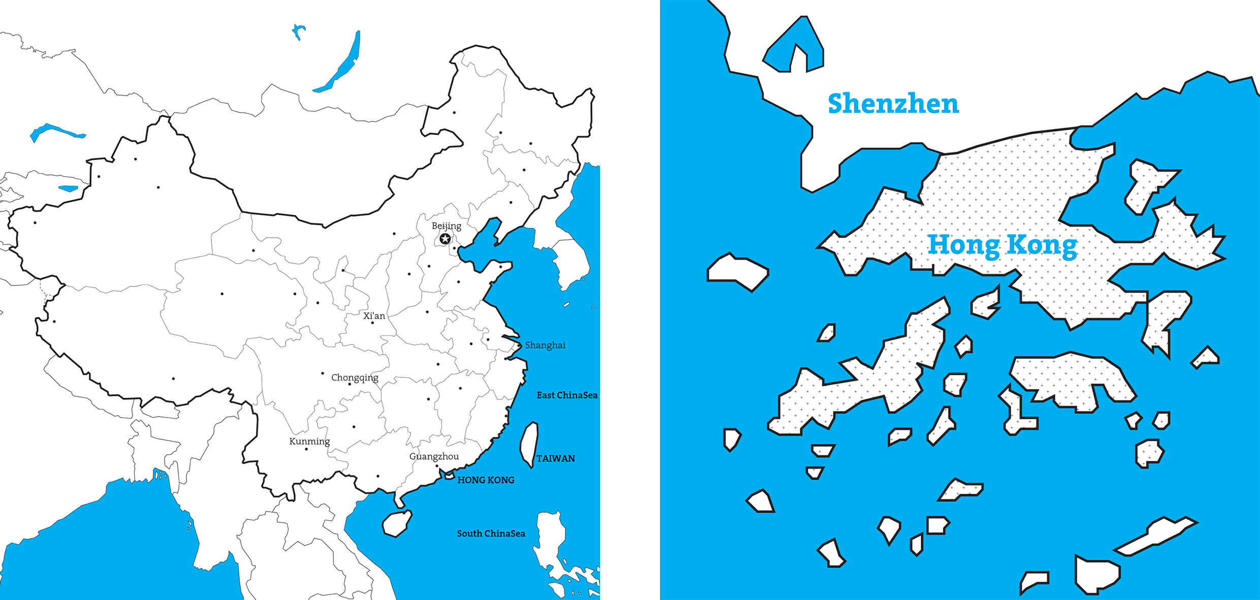
Figure 1. Large scale maps.
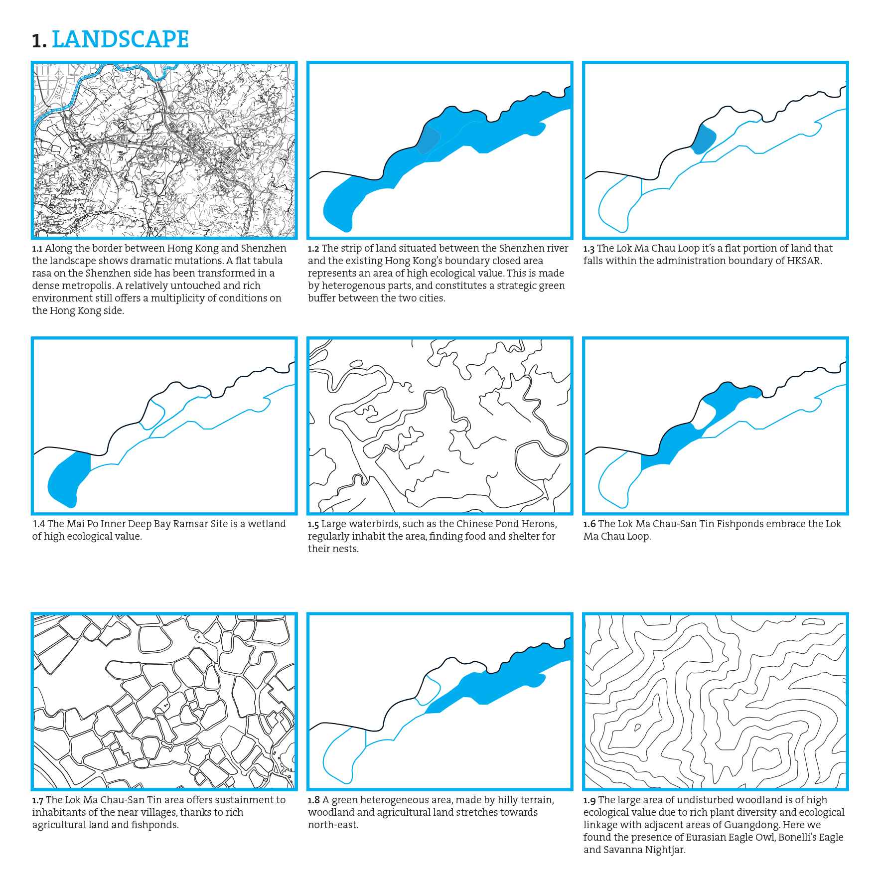
Figure 2. Landscape.
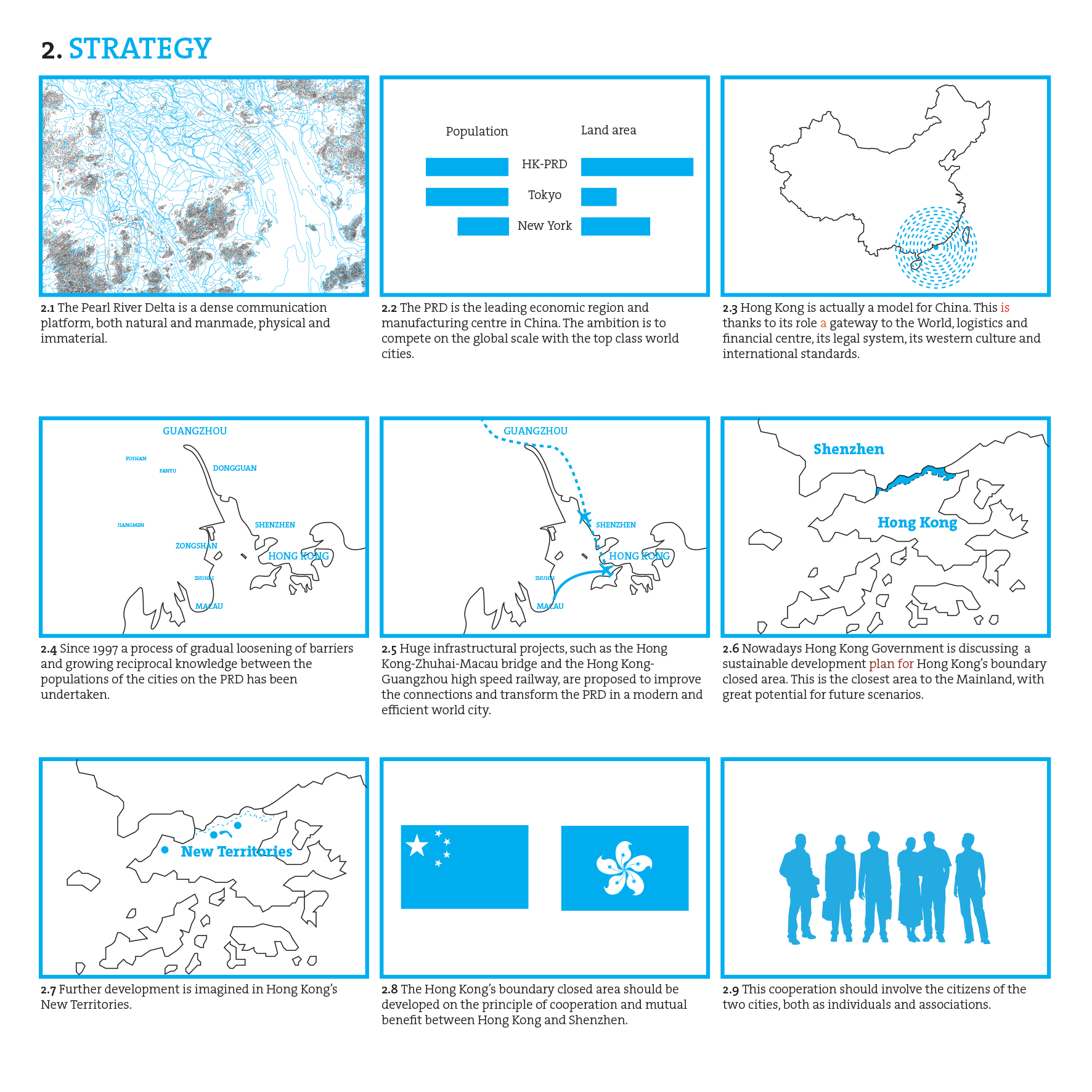
Figure 3. Strategy.
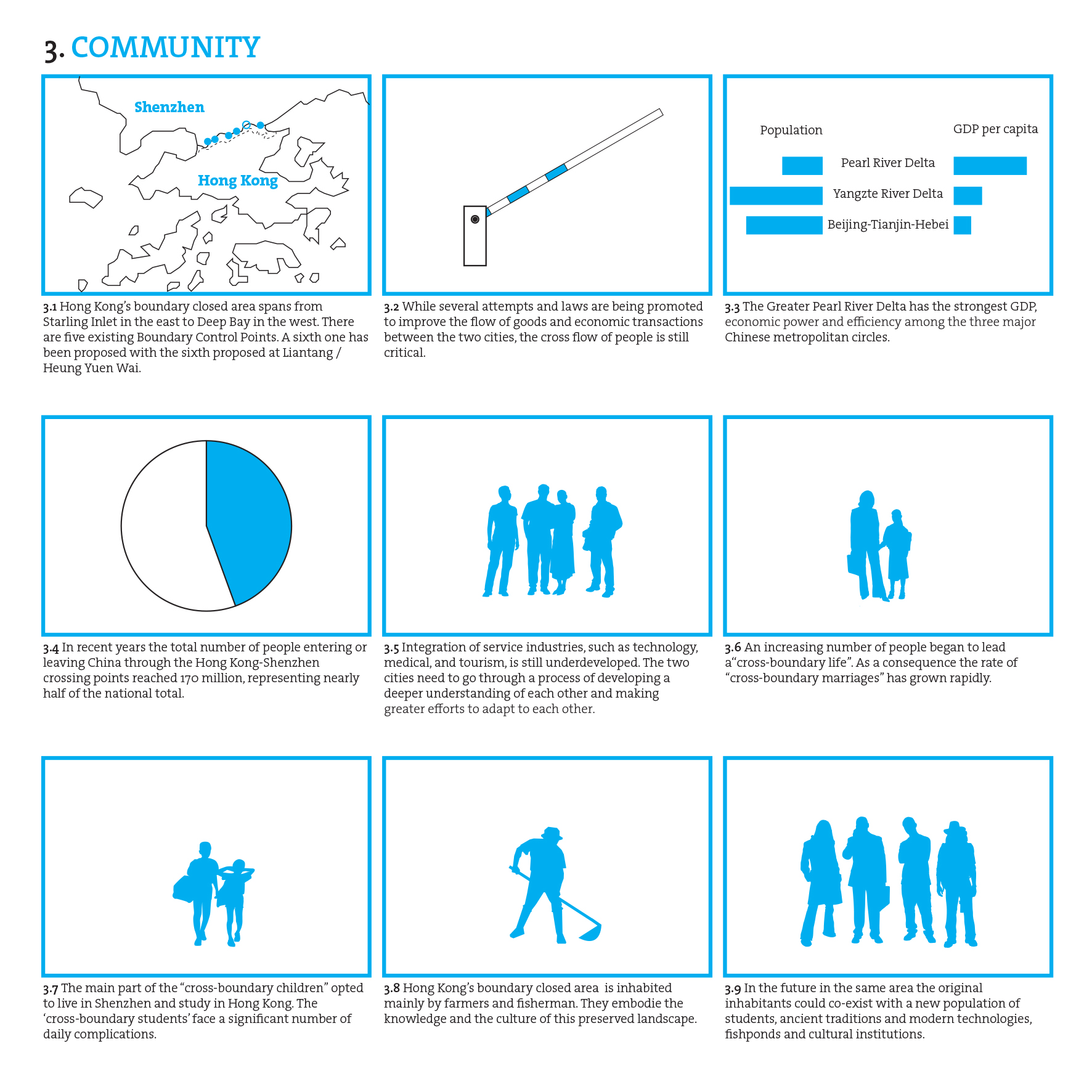
Figure 4. Community.
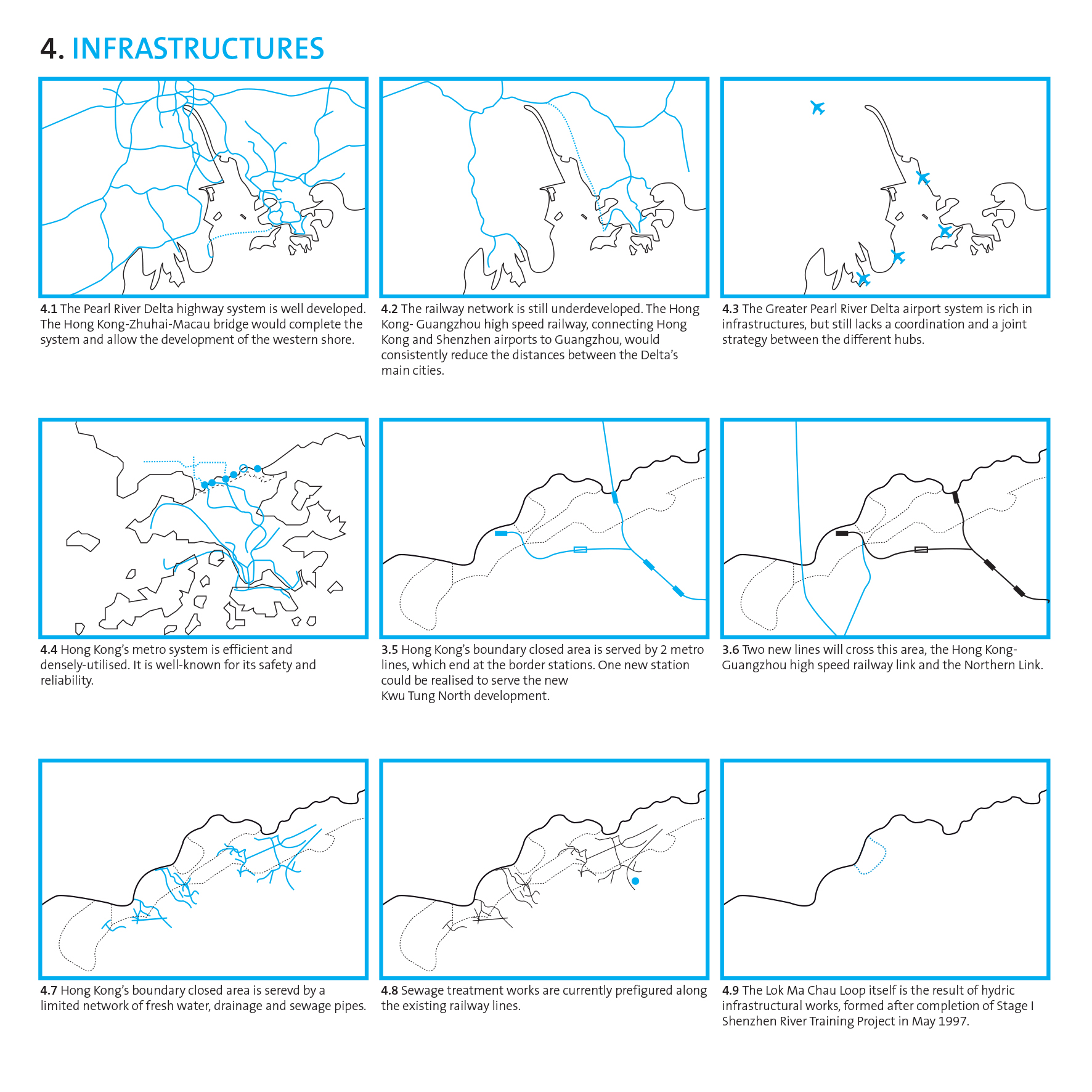
Figure 5. Infrastructure.
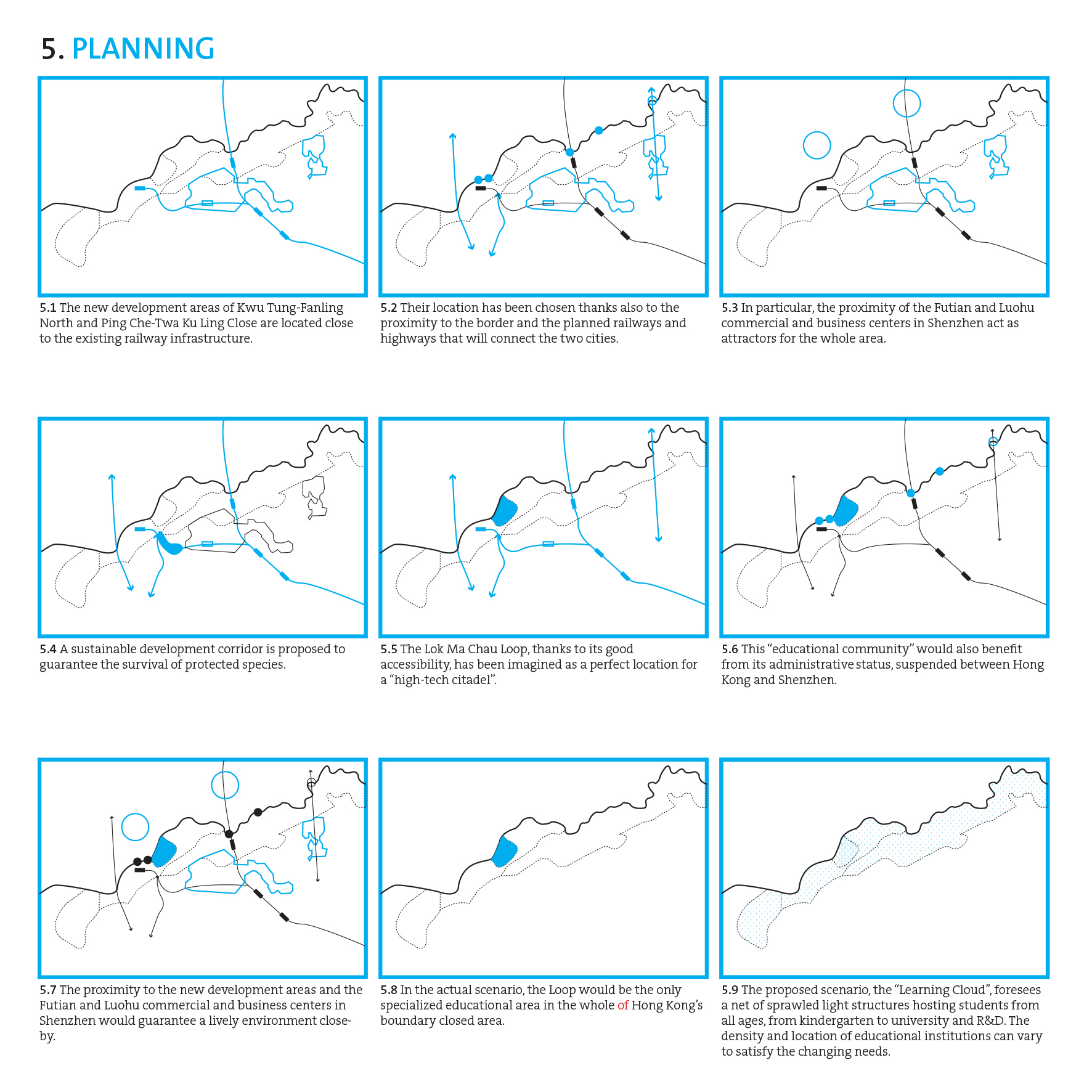
Figure 6. Planning.
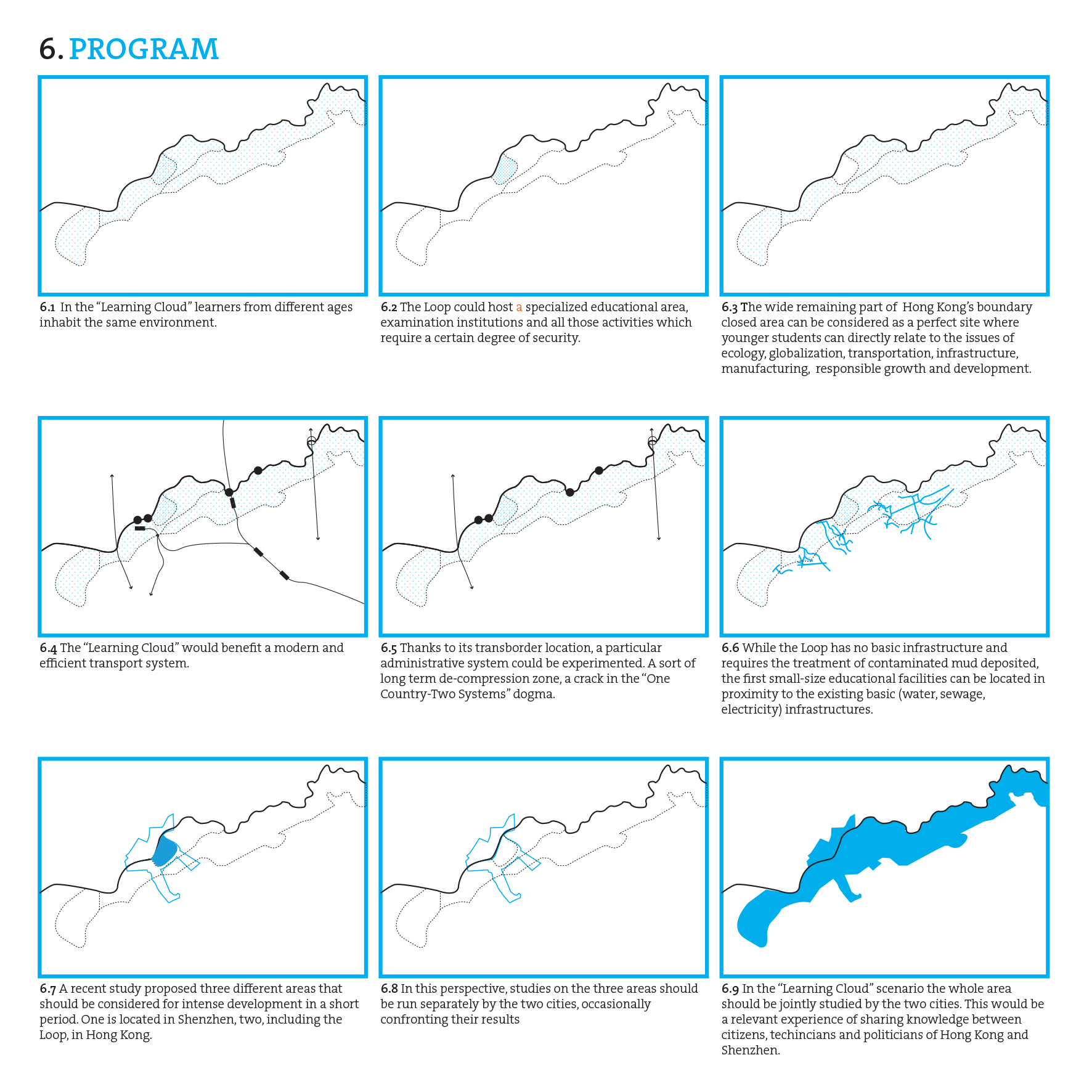
Figure 7. Program.
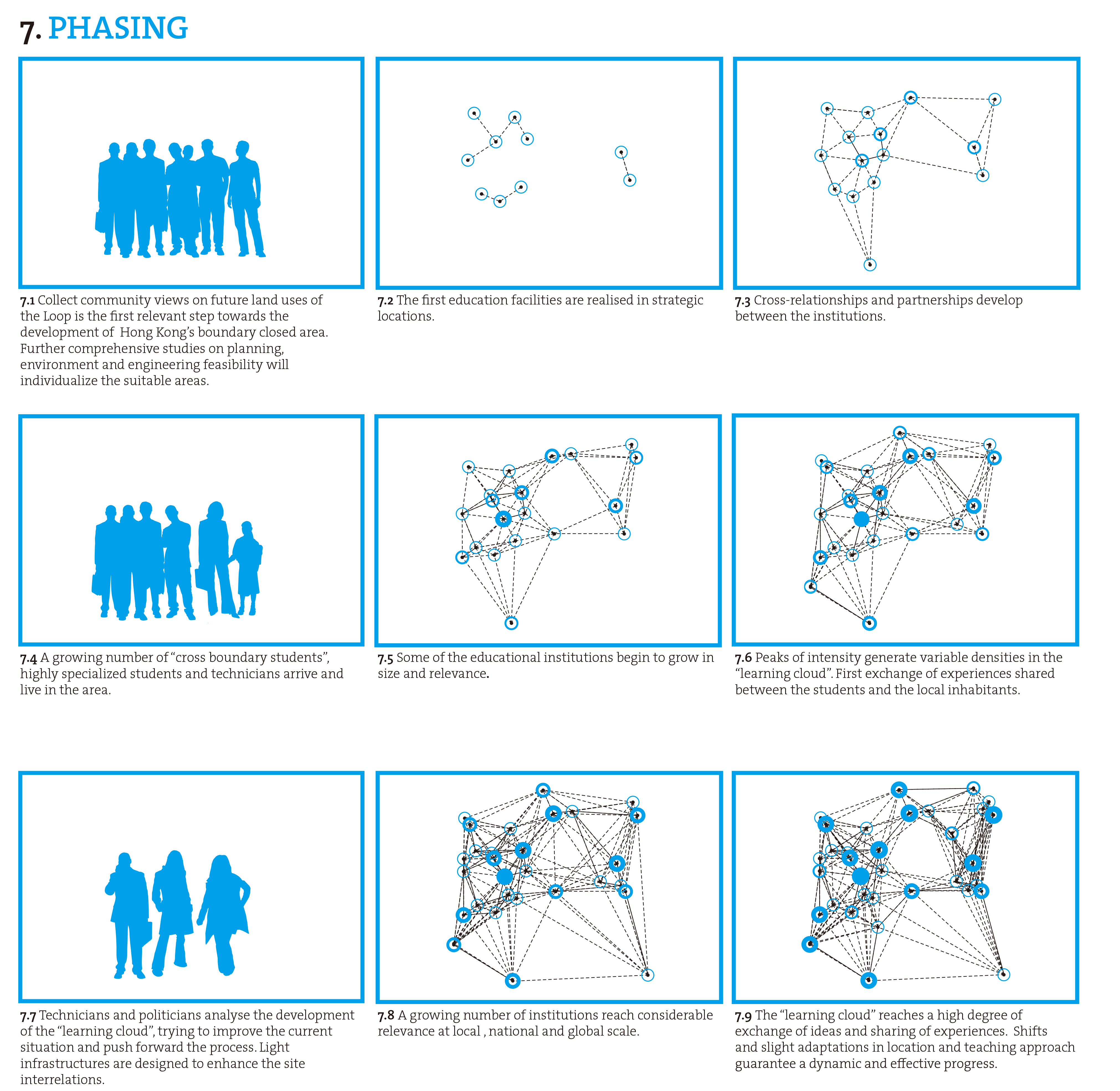
Figure 8. Phasing.
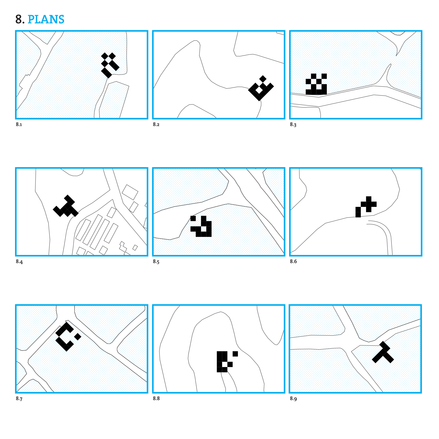
Figure 9. Plans. The “Learning Cloud” facilities are designed with flexibility following a careful reading of the context, ranging from flat wet environments to hilly terrains.
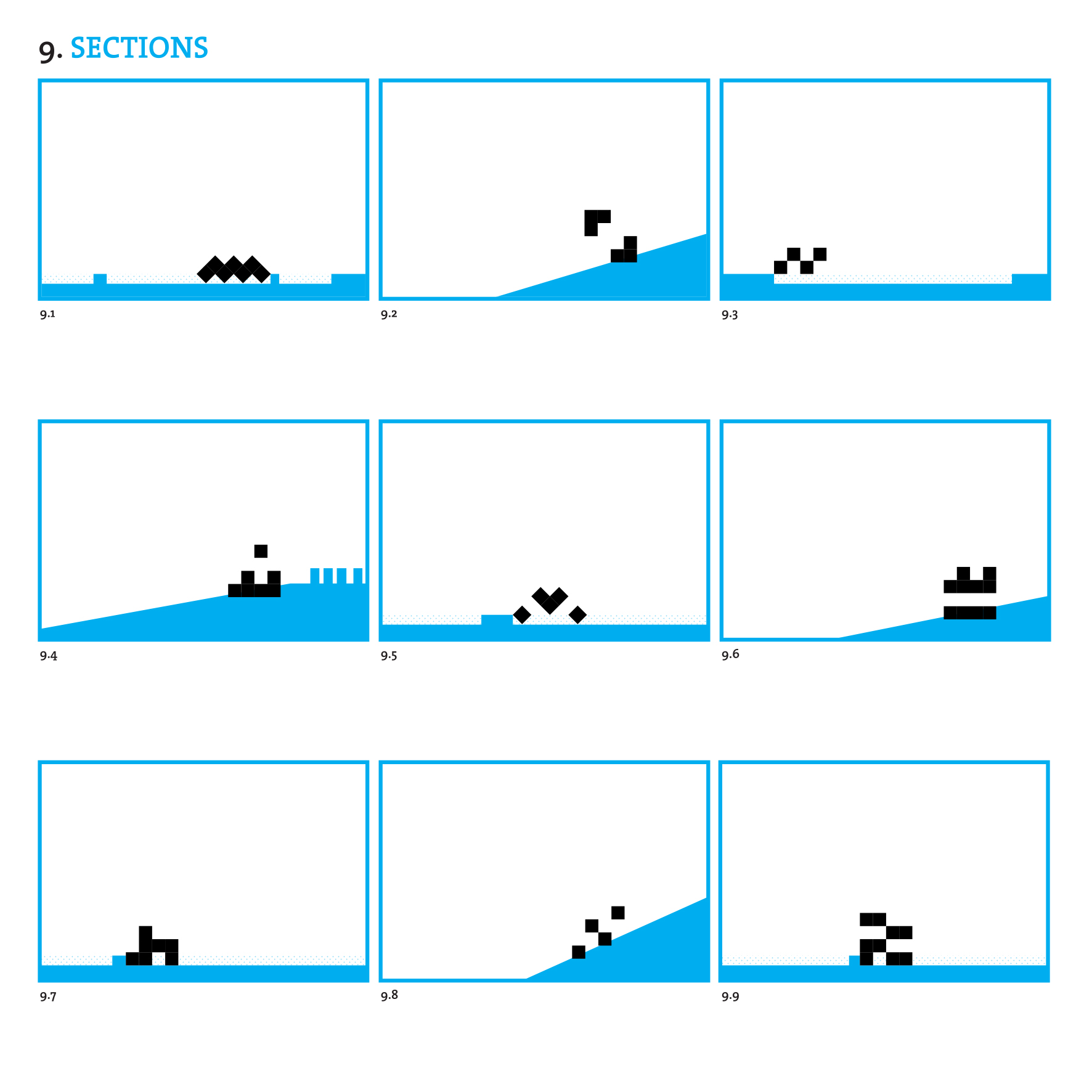
Figure 10. Sections. The “Learning Cloud” facilities establish a subtle relationship with the topographical conditions of the site in which they are immersed, allowing also the gaze to wander in this diverse border context.
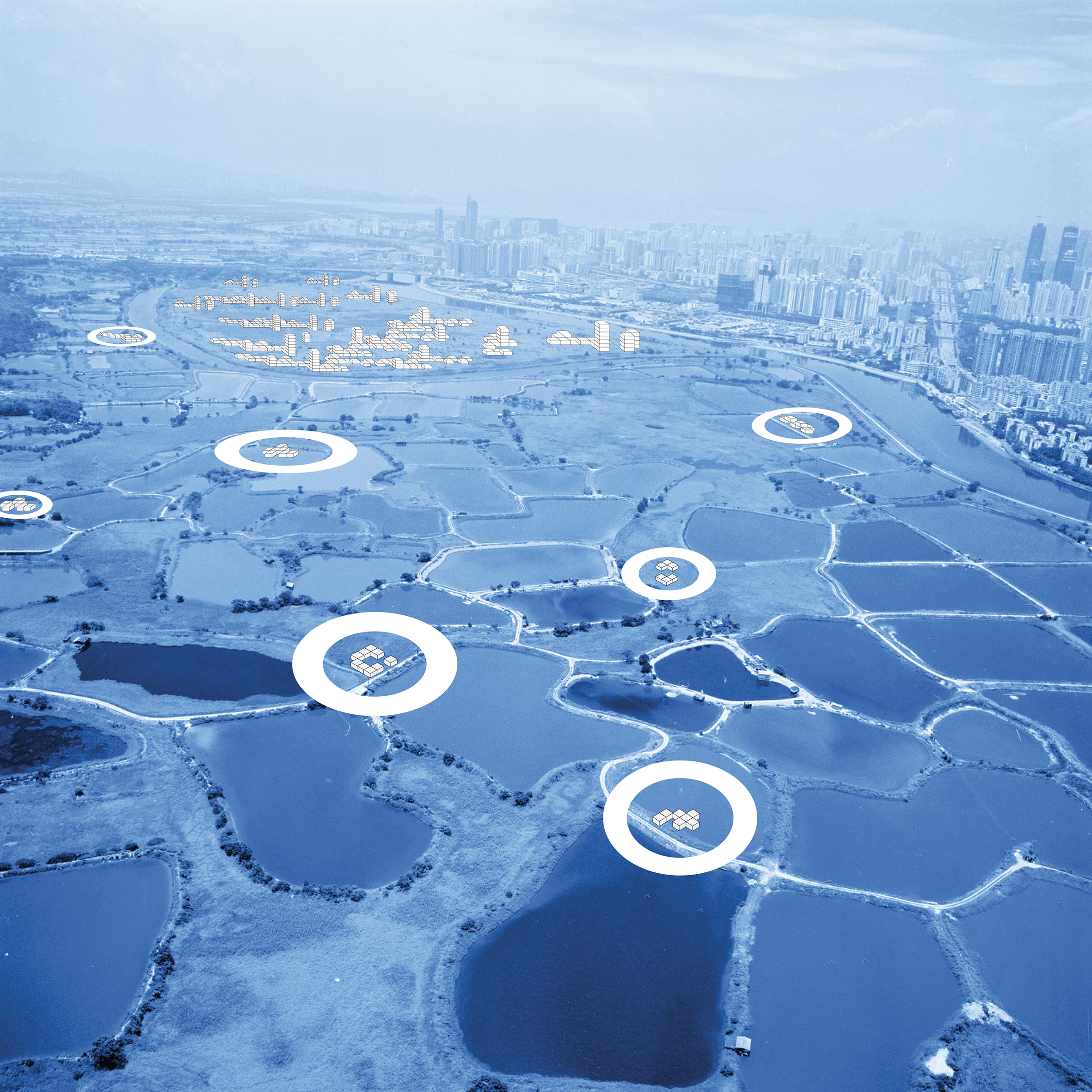
Figure 11. Salottobuono_View of the Learning Cloud.
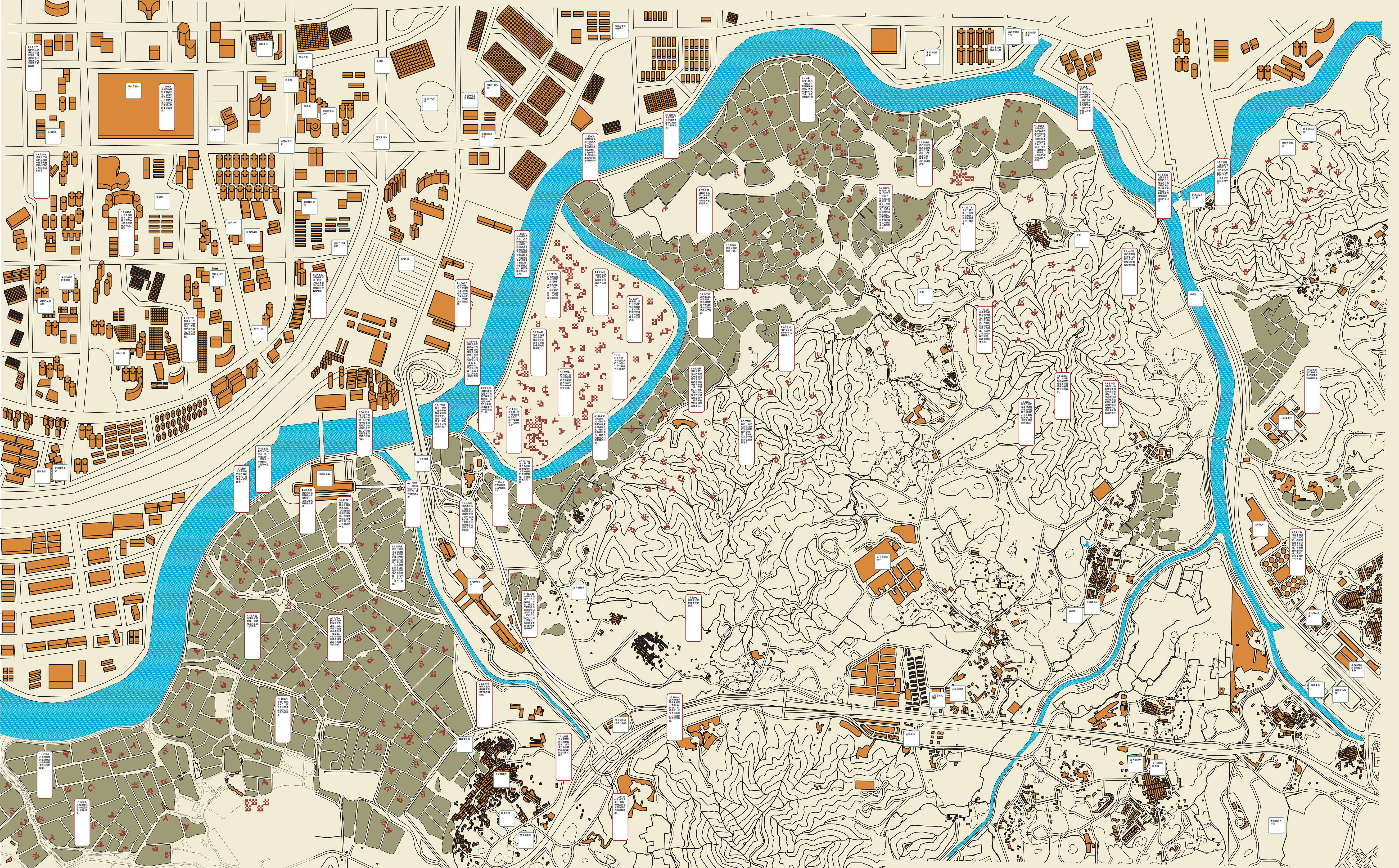
Figure 12. Salottobuono_Territorial scale map of the Lok Ma Chau Loop and Hong Kong’s boundary closed area.
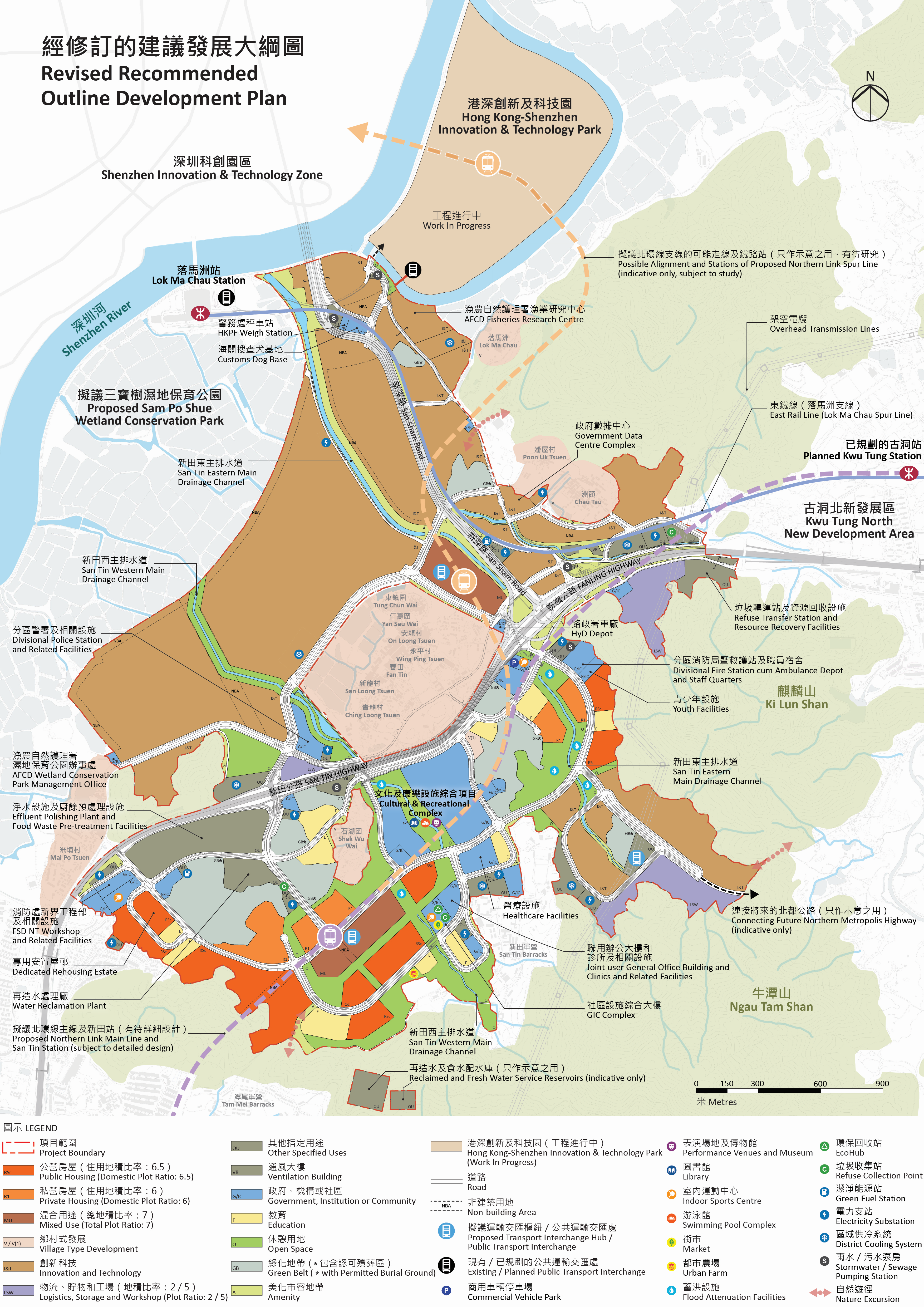
Figure 13. Map of the San Tin Technopole, which covers a development area of 626 hectares, including the LMC Loop (87 ha), the I&T Park and San Tin Town Centre. Source: San Tin Technopole, 2023.
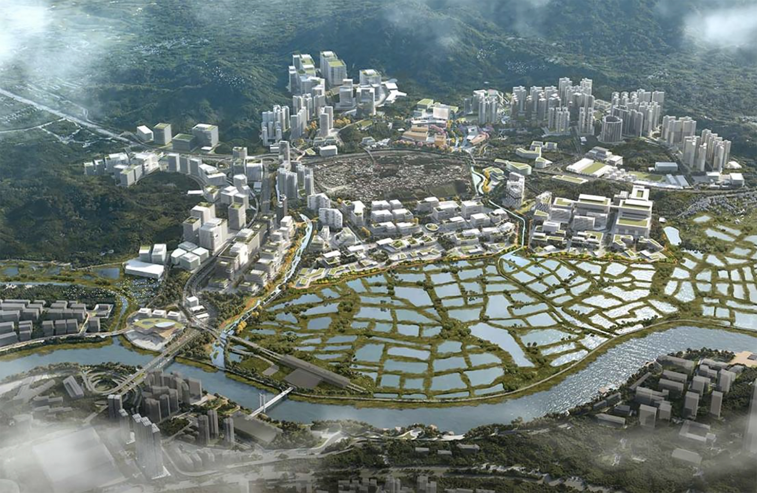
Figure 14. Aerial view of the San Tin Technopole. On the left, part of the foreseen development for the LMP Loop into Hong Kong & Shenzhen Innovation & Technology Park. Source: San Tin Technopole, 2023.