Urbanie & Urbanus

Issue 2025 Jan
Counter-Urbanization
Issue 11, P. - P.
Figures
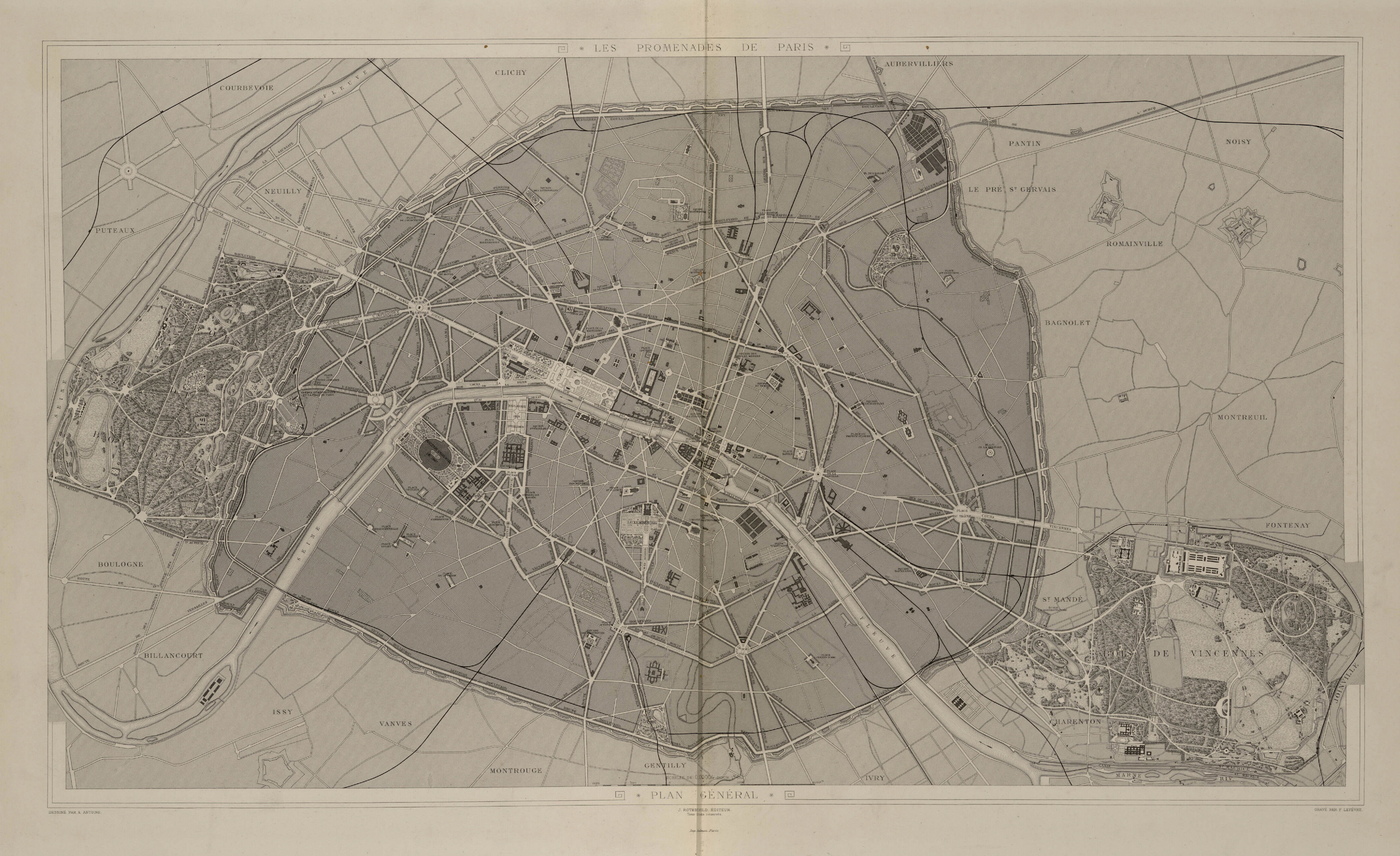
Figure 1. Adolphe Alphand – 1867 – Les Promenades de Paris – illustrating the systematic and hierarchical network of pleasure grounds: from suburban parks (Bois de Vincennes and Bois de Boulogne) to street trees, including intraurban parks and squares - Courtesy of the Bibliothèque nationale de France.
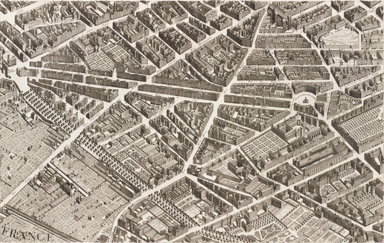
Figure 2. Except from Turgot's Map – 1734 – View of the boulevards built on the wall of Philippe Auguste in Paris – Courtesy of the Bibliothèque nationale de France.
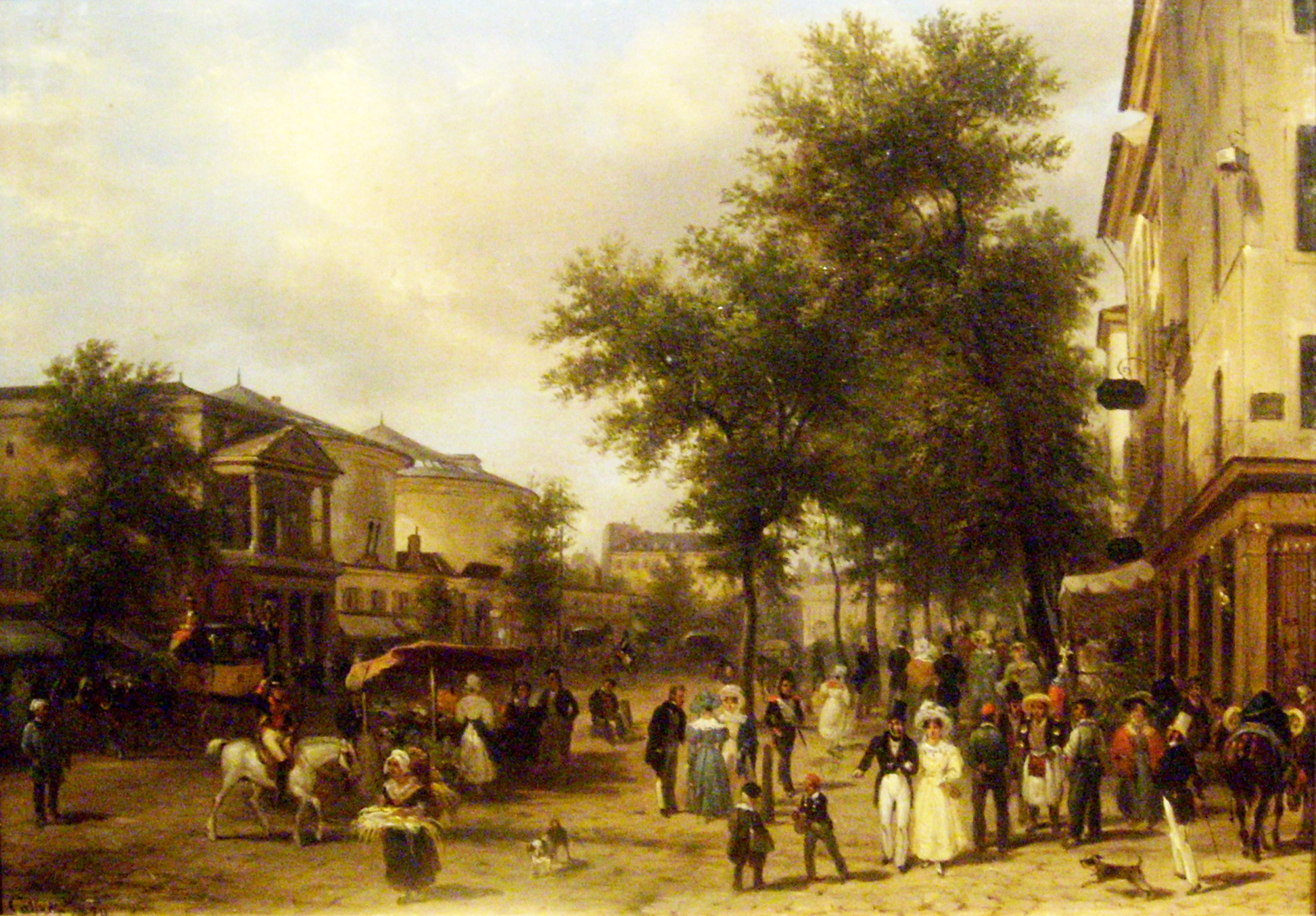
Figure 3. Giuseppe Canella – 1830 – Boulevard Montmartre in Paris – Courtesy of the Musée Thomas-Henry.
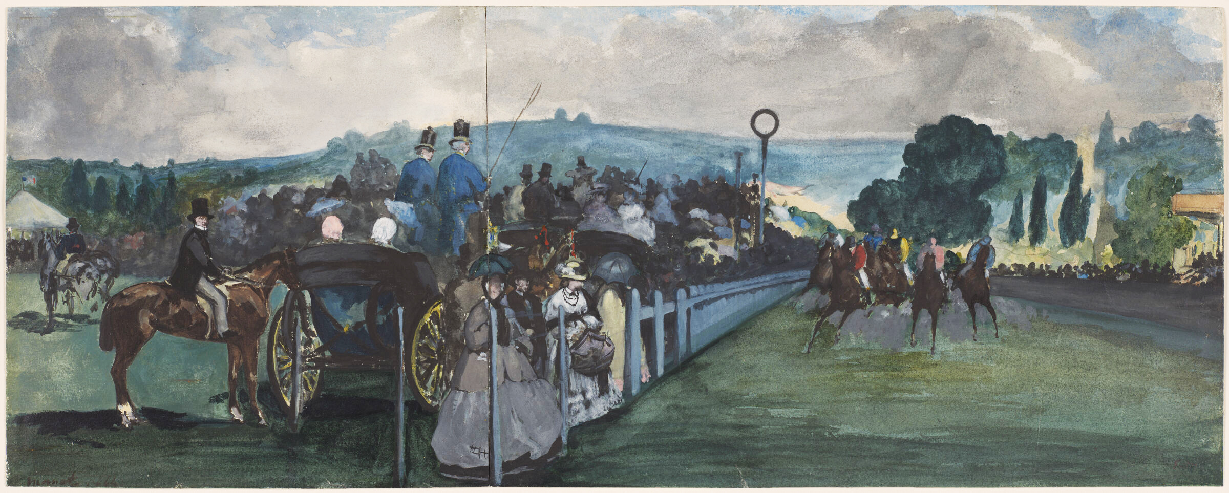
Figure 4. Edouard Manet – 1864 – Race Course at Longchamp – Courtesy of the Harvard Art Museums.
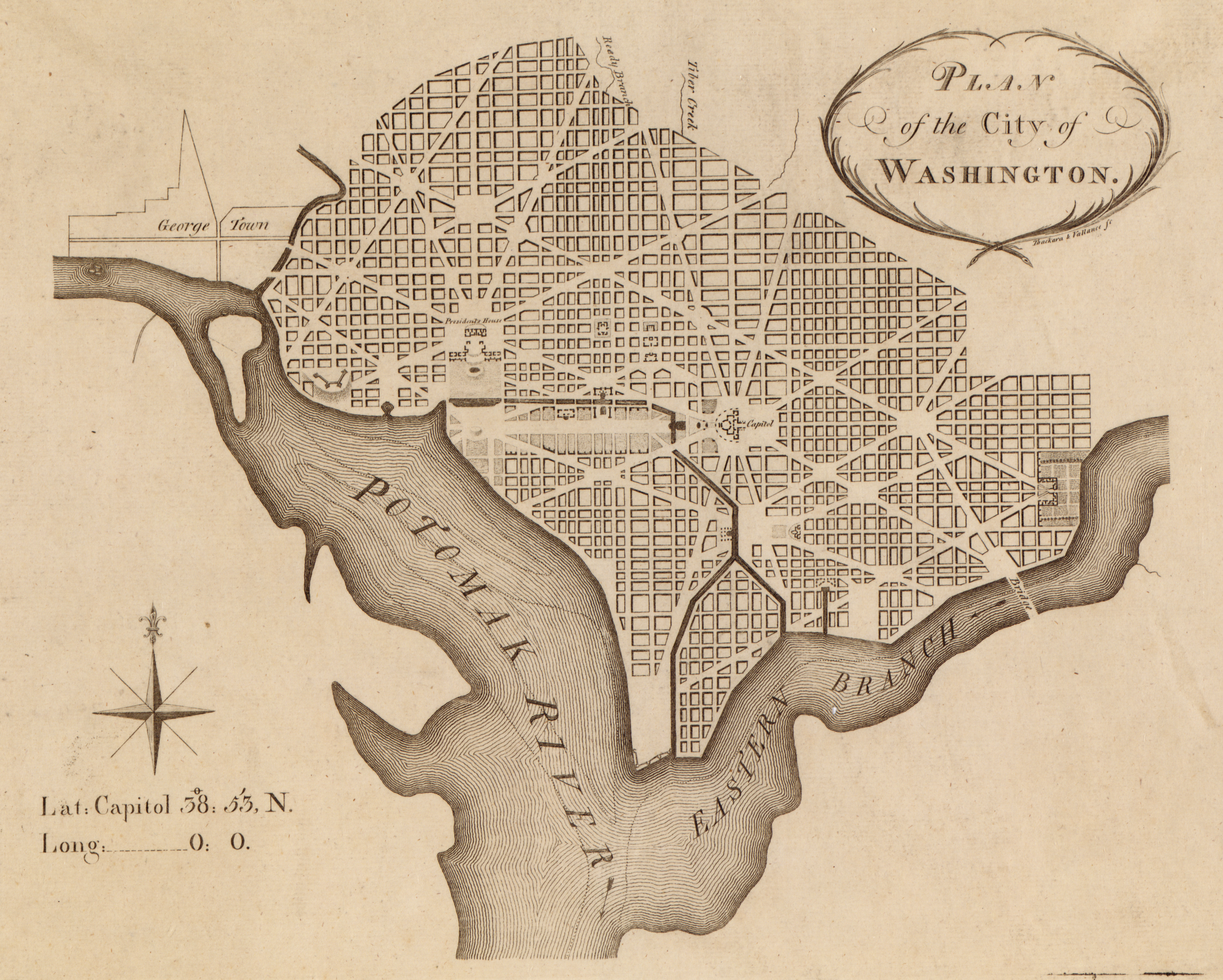
Figure 5. Pierre-Charles L'Enfant - 1792 - Plan of the city of Washington – Courtesy of the Library of Congress.
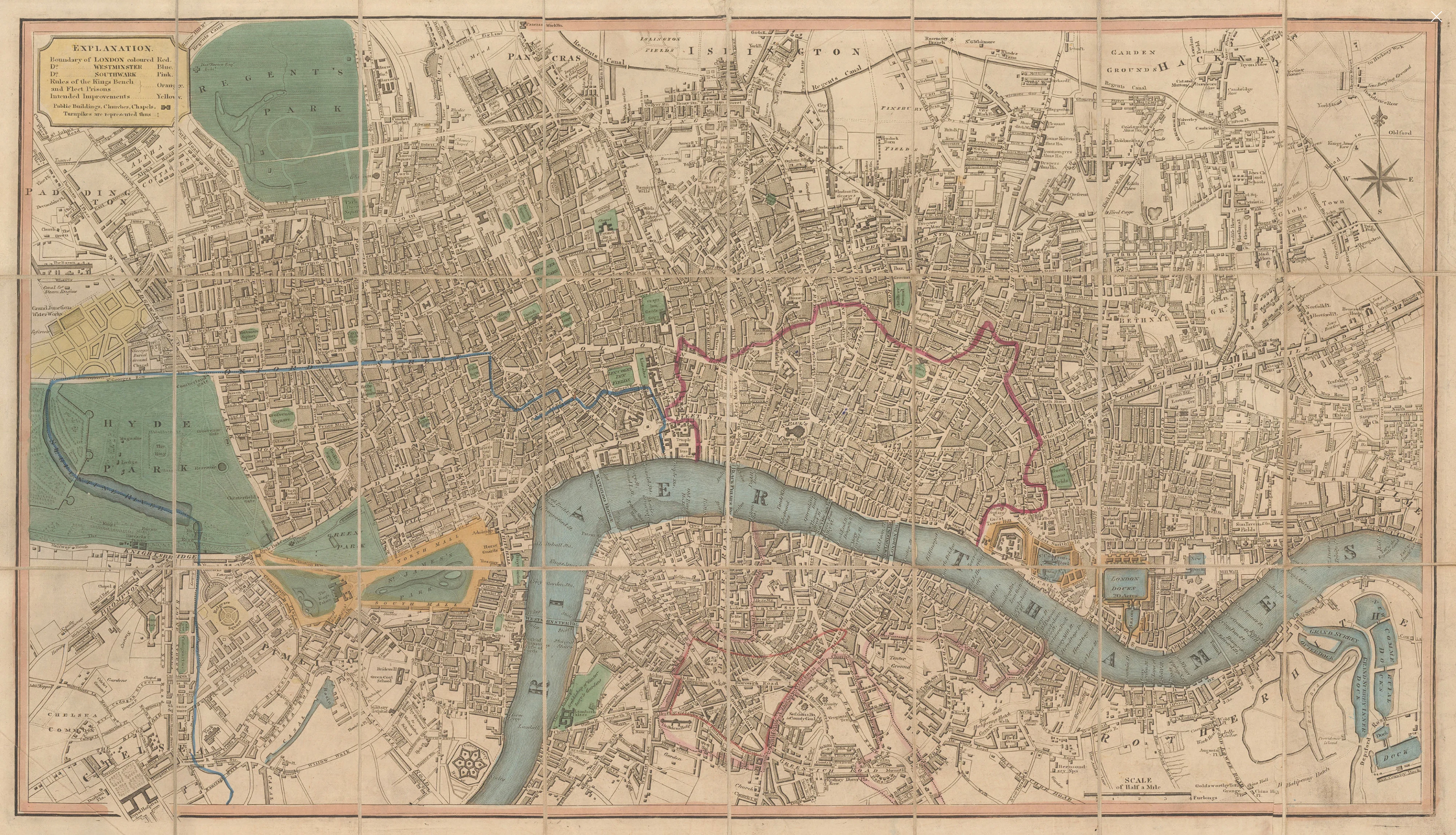
Figure 6. Smith's New Map of London – c.1830 – Depicting the Chain of Parks in the west of the city: Hyde Park, Green Park, and St. James’s Park – Courtesy of MAPCO.
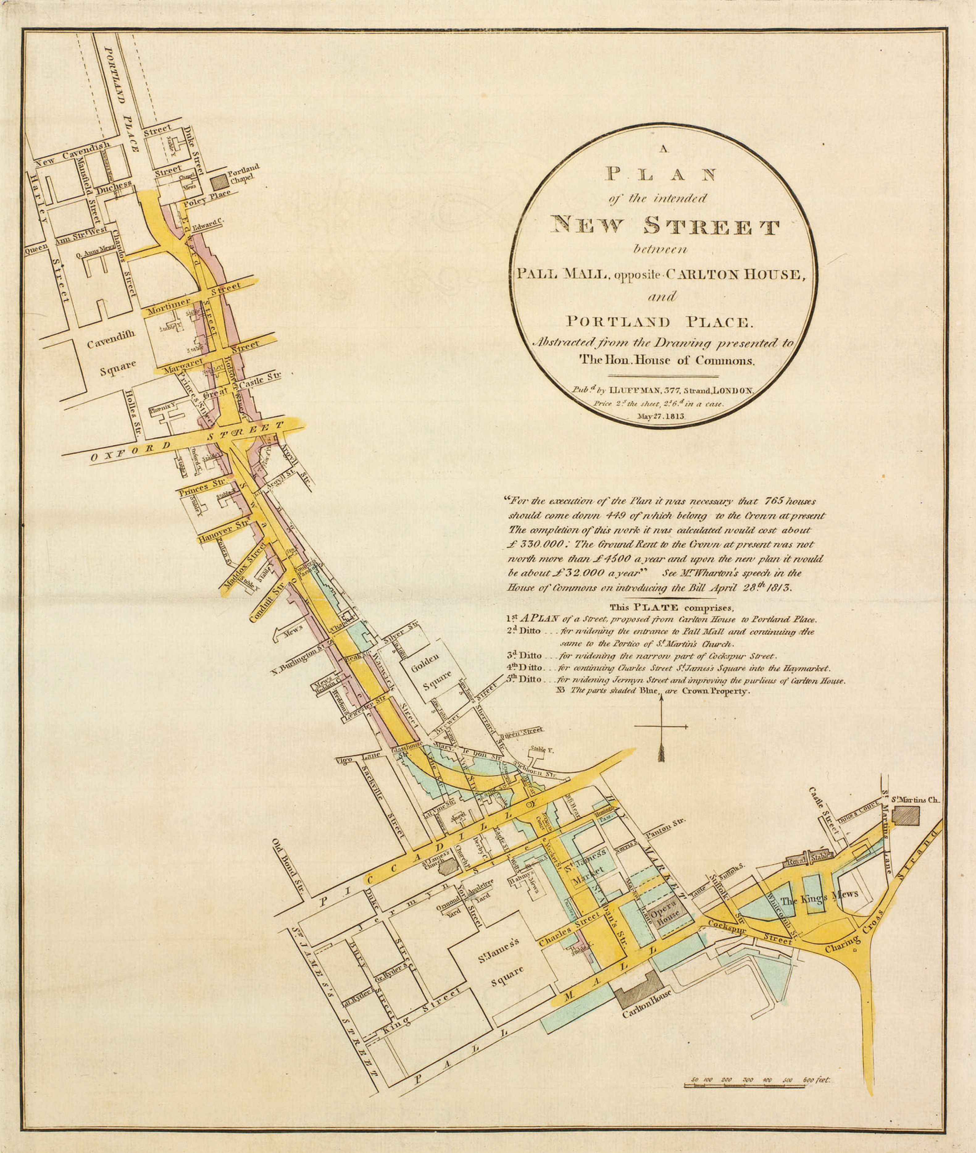
Figure 7. John Nash - 1818 – ‘A Plan of the intended New Street between Pall Mall opposite Carlton House, and Portland Place’ – Courtesy of the Royal Collection Trust.
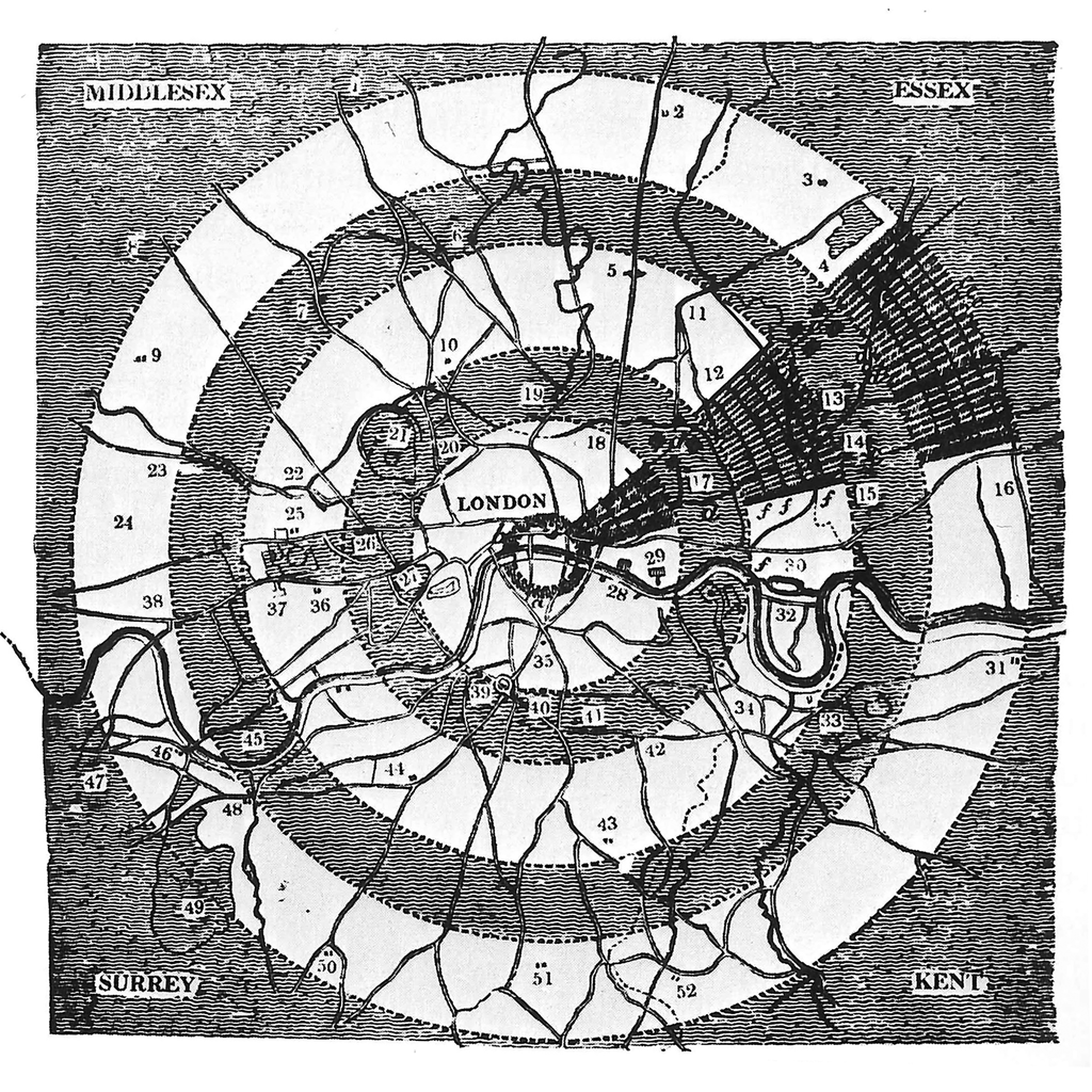
Figure 8. John Claudius Loudon – 1829 – Green belts around London – Courtesy of the Biodiversity Heritage Library.
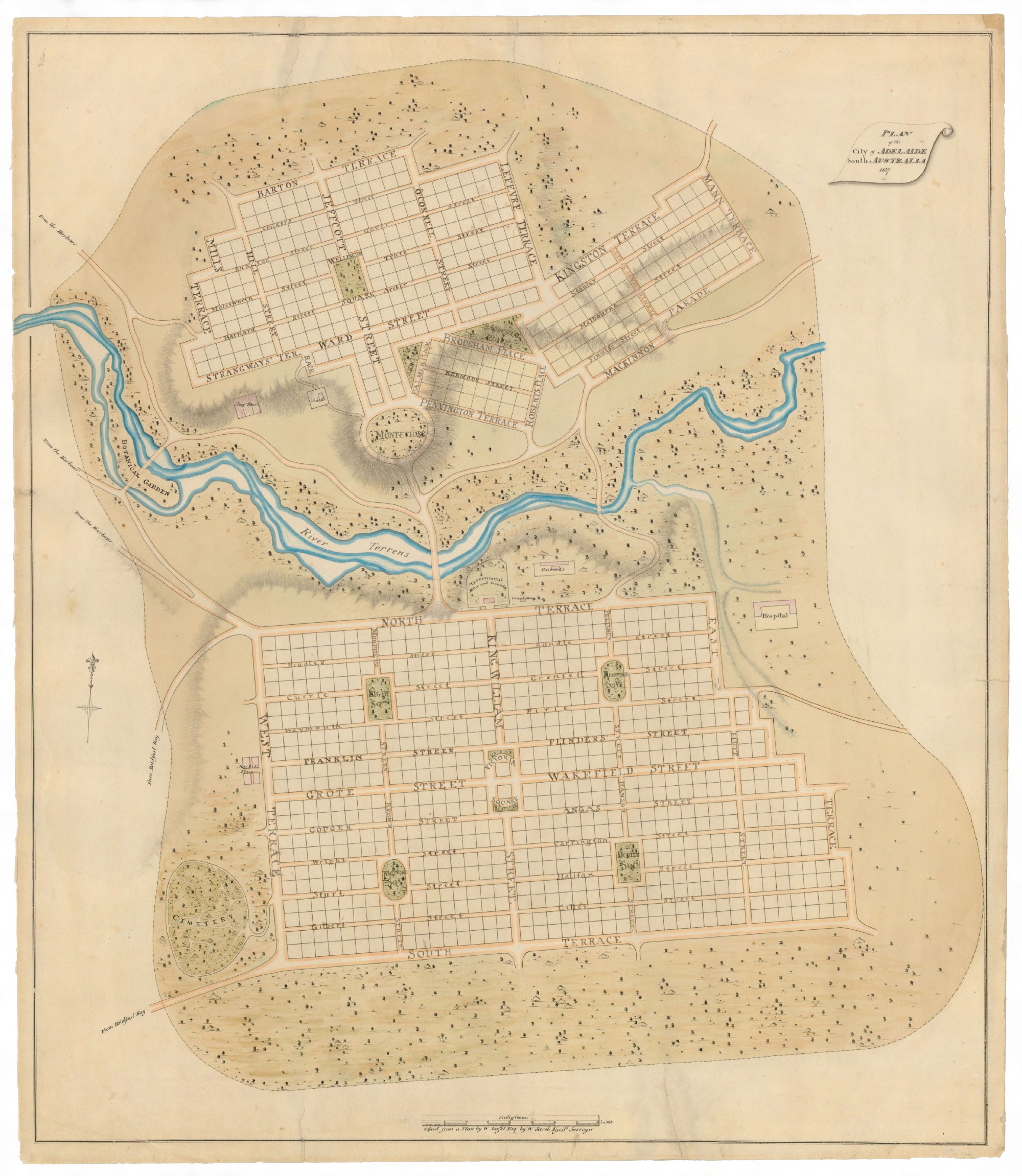
Figure 9. William Light – 1837 – Plan of the City of Adelaide – Courtesy of Experience Adelaide.